San Saba River.
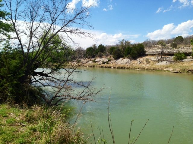
The San Saba River is one of the most scenic waterways in the Texas Hill Country. It contains sparkling, clear water that flows through limestone bluffs and hills, supporting fish, wildlife, agriculture and livestock. The San Saba River forms near Fort McKavett and flows 140 miles through Menard, Mason, McCulloch and San Saba Counties, where it converges with the Colorado River.
The flow of the Upper San Saba River has been threatened since 1994 due to unregulated, excessive, illegal and wasteful pumping and diversion, and often weaker than normal natural spring output, leaving a 45 mile stretch of the river essentially dry many years between June and October. The lack of water flow has damaged the river ecosystem, endangered freshwater mussels and fish found only in the Central Texas Region, and hurt downstream ranchers and businesses who depend on the San Saba River for livestock production and business income.
See San Saba River Threats for information about specific threats to the San Saba River.
Friends of the San Saba
Friends of the San Saba (FOSS) was created in 2012 to protect the water flow of the San Saba River. FOSS members include riparian landowners along the San Saba River and other concerned citizens that have no other agenda than to keep the San Saba River flowing.
- Commissioned studies on the hydrology of the San Saba River, which identified unregulated and illegal pumping.
- Submitted complaints about illegal pumping and noncompliance to the Texas Commission on Environmental Quality (TCEQ), the state agency responsible for regulating surface water rights and availability.
- Reviewed hundreds of pages of TCEQ investigative reports and other documents.
- Met with state legislators, TCEQ commissioners and TCEQ senior leadership to discuss unregulated, excessive, illegal and wasteful pumping that turns the San Saba River into a dried-up riverbed.
- Participated in TCEQ watermaster evaluations by submitting comments and attending Town Hall meetings.
- Supported research on endangered freshwater mussels by the Texas Parks and Wildlife Department (TPWD), the U.S. Fish and Wildlife Service (USFWS), Texas A&M, Texas State University, Texas A&M AgriLife Research and The Nature Conservancy.
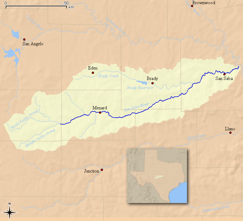
San Saba River Map
The San Saba River forms near the Schleicher and Menard County line and flows 140 miles through Menard, Mason, McCulloch and San Saba Counties, where it converges with the Colorado River.

Map Highlights:
- San Saba River is formed by confluence of North Valley Prong and the Middle Valley Prong and by
natural springs at Fort McKavett and Clear Creek Springs. - Menard Irrigation Company (MIC) Canal and alluvial wells in and around Menard.
- 45 mile stretch of river east of Menard is essentially dry between June and October in many years since 2000.
- Brady Creek converges into San Saba River resulting in consistent water flow in San Saba County.
- San Saba River converges into Colorado River 10 miles east of San Saba.
Friends of the San Saba (FOSS) Directors
The FOSS directors are riparian landowners on the San Saba River in Menard, Mason and McCulloch counties


